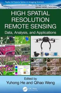
نام کتاب: High Spatial Resolution Remote Sensing
نویسنده: He Y. و Weng Q Ed.
ویرایش: ۱
سال انتشار: ۲۰۱۸
کد ISBN کتاب: ۹۷۸۱۴۹۸۷۶۷۶۸۲,
فرمت: PDF
تعداد صفحه: ۴۰۷
انتشارات: CRC Press
Description About Book High Spatial Resolution Remote Sensing From Amazon
High spatial resolution remote sensing is an area of considerable current interest and builds on developments in object-based image analysis, commercial high-resolution satellite sensors, and UAVs. It captures more details through high and very high resolution images (10 to 100 cm/pixel). This unprecedented level of detail offers the potential extraction of a range of multi-resource management information, such as precision farming, invasive and endangered vegetative species delineation, forest gap sizes and distribution, locations of highly valued habitats, or sub-canopy topographic information. Information extracted in high spatial remote sensing data right after a devastating earthquake can help assess the damage to roads and buildings and aid in emergency planning for contact and evacuation.
To effectively utilize information contained in high spatial resolution imagery, High Spatial Resolution Remote Sensing: Data, Analysis, and Applications addresses some key questions:
What are the challenges of using new sensors and new platforms?
What are the cutting-edge methods for fine-level information extraction from high spatial resolution images?
How can high spatial resolution data improve the quantification and characterization of physical-environmental or human patterns and processes?
The answers are built in three separate parts: (1) data acquisition and preprocessing, (2) algorithms and techniques, and (3) case studies and applications. They discuss the opportunities and challenges of using new sensors and platforms and high spatial resolution remote sensing data and recent developments with a focus on UAVs. This work addresses the issues related to high spatial image processing and introduces cutting-edge methods, summarizes state-of-the-art high spatial resolution applications, and demonstrates how high spatial resolution remote sensing can support the extraction of detailed information needed in different systems. Using various high spatial resolution data, the third part of this book covers a range of unique applications, from grasslands to wetlands, karst areas, and cherry orchard trees.
درباره کتاب High Spatial Resolution Remote Sensing ترجمه شده از گوگل
سنجش از راه دور با قدرت تفکیک مکانی بالا منطقه مورد علاقه فعلی قابل توجه است و بر اساس تحولات در تجزیه و تحلیل تصویر مبتنی بر شی، سنسورهای ماهواره ای با وضوح بالا تجاری، و پهپاد. این برنامه جزئیات بیشتر را از طریق تصاویر با وضوح بالا و بسیار بالا (۱۰ تا ۱۰۰ سانتی متر / پیکسل) است. این سطح بی سابقه ای از پیشنهادات جزئیات استخراج پتانسیل یک طیف وسیعی از چند منبع اطلاعات مدیریت، از جمله کشاورزی دقیق، تهاجمی و خطر انقراض گونه های رویشی طرح، اندازه شکاف جنگل و توزیع، مکان زیستگاه بسیار با ارزش، و یا اطلاعات توپوگرافی زیر سایه بان. اطلاعات در فضایی بالا اطلاعات سنجش از دور سمت راست پس از زلزله ویرانگر استخراج شده را می ارزیابی خسارت به جاده ها و ساختمان ها و کمک در برنامه ریزی اضطراری برای ارتباط و تخلیه کمک کند.
به طور موثر استفاده از اطلاعات موجود در تصاویر با وضوح فضایی بالا، بالا فضایی قطعنامه سنجش از دور: داده ها، تجزیه و تحلیل، و برنامه های کاربردی آدرس چند سوال کلیدی:
چالش های استفاده از سنسور جدید و سیستم عامل های جدید چیست؟
روش برش لبه برای استخراج اطلاعات در سطح خوب از تصاویر با وضوح فضایی بالا چیست؟
چگونه می توانم اطلاعات با وضوح بالا فضایی بهبود کمی و شناسایی الگوهای فیزیکی و زیست محیطی و یا انسان و فرآیندهای؟
(۱) اکتساب داده ها و پردازش، (۲) الگوریتم و تکنیک، و (۳) مطالعات موردی و برنامه های کاربردی: پاسخ ها در سه بخش جداگانه ساخته شده است. آنها فرصت ها و چالش های استفاده از سنسور جدید و سیستم عامل و قدرت تفکیک مکانی بالا از راه دور داده های سنجش از و تحولات اخیر با تمرکز بر پهپاد مورد بحث است. آدرس این کار مسائل مربوط به پردازش تصویر فضایی بالا و معرفی برش لبه روش ها، خلاصه دولت از هنر برنامه های کاربردی قدرت تفکیک فضایی بالا و نشان میدهد که چگونه سنجش از دور قدرت تفکیک مکانی بالا می توانید استخراج اطلاعات دقیق مورد نیاز در سیستم های مختلف پشتیبانی . با استفاده از داده های مختلف قدرت تفکیک مکانی بالا، بخش سوم این کتاب شامل طیف وسیعی از برنامه های کاربردی منحصر به فرد، از مراتع به تالاب ها، مناطق کارست، و درختان باغ آلبالو.
[box type=”info”]![]() جهت دسترسی به توضیحات این کتاب در Amazon اینجا کلیک کنید.
جهت دسترسی به توضیحات این کتاب در Amazon اینجا کلیک کنید.![]() در صورت خراب بودن لینک کتاب، در قسمت نظرات همین مطلب گزارش دهید.
در صورت خراب بودن لینک کتاب، در قسمت نظرات همین مطلب گزارش دهید.

