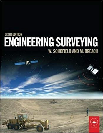
نام کتاب: Engineering Surveying
نویسنده:
ویرایش: ۶
سال انتشار: ۲۰۰۷
فرمت: PDF
تعداد صفحه: ۶۴۰
انتشارات: Butterworth-Heinemannress
Description About Book Engineering Surveying From Amazon
Engineering surveying involves determining the position of natural and man-made features on or beneath the Earth’s surface and utilizing these features in the planning, design and construction of works. It is a critical part of any engineering project. Without an accurate understanding of the size, shape and nature of the site the project risks expensive and time-consuming errors or even catastrophic failure.
Engineering Surveying 6th edition covers all the basic principles and practice of this complex subject and the authors bring expertise and clarity. Previous editions of this classic text have given readers a clear understanding of fundamentals such as vertical control, distance, angles and position right through to the most modern technologies, and this fully updated edition continues that tradition.
This sixth edition includes:
* An introduction to geodesy to facilitate greater understanding of satellite systems
* A fully updated chapter on GPS, GLONASS and GALILEO for satellite positioning in surveying
* All new chapter on the important subject of rigorous estimation of control coordinates
* Detailed material on mass data methods of photogrammetry and laser scanning and the role of inertial technology in them
With many worked examples and illustrations of tools and techniques, Engineering Surveying is essential reading for students and professionals alike involved in surveying, civil, structural and mining engineering, and related areas such as geography and mapping.
Wilf Schofield was formerly Principal Lecturer in Civil Engineering at Kingston University; Mark Breach is the Principal Lecturer in Engineering Surveying at Nottingham Trent University and serves on technical committees of the RICS and ICES.
* Comprehensive introduction to surveying for engineers
* All basic and advanced techniques explained and illustrated with worked examples
* Expanded coverage of modern instrumentation and satellite positioning
درباره کتاب Engineering Surveying – ترجمه شده از گوگل
نقشه برداری مهندسی شامل تعیین موقعیت ویژگی های طبیعی و انسانی در سطح و یا زیر سطح زمین و استفاده از این ویژگی ها در برنامه ریزی، طراحی و ساخت آثار است. این بخش مهمی از هر پروژه مهندسی است. بدون درک دقیق از اندازه، شکل و ماهیت سایت پروژه خطرات گران و وقت گیر خطا و یا حتی شکست فاجعه بار است.
نظرسنجی مهندسی نسخه ۶ تمام اصول اساسی و عملی این موضوع پیچیده را پوشش می دهد و نویسندهتخصص و وضوح را ارائه می دهند. نسخه های قبلی این متن کلاسیک، خوانندگان را درک روشنی از اصول مانند کنترل عمودی، فاصله، زاویه ها و موقعیت را از طریق تکنولوژی های مدرن به ارمغان آورده است، و این نسخه به طور کامل به روز شده این سنت را ادامه می دهد.
این نسخه ششم شامل موارد زیر است:
* مقدمه ای برای زمین شناسی برای تسهیل درک بیشتر از سیستم های ماهواره ای
* فصل به طور کامل به روز شده در GPS، GLONASS و GALILEO برای موقعیت ماهواره ای در نقشه برداری
* تمام فصل جدید در مورد موضوع مهم برآورد دقیق مختصات کنترل
* اطلاعات مفصلی در مورد روشهای جرم داده شده در فتوگرامتری و اسکن لیزر و نقش فناوری inertial در آنها
با بسیاری از نمونه های کار شده و تصاویر ابزارها و تکنیک ها، Surveying Engineering خواندن ضروری برای دانشجویان و حرفه ای است که در زمینه نظارت، مهندسی عمران، ساخت و ساز و مهندسی معدن و زمینه های مرتبط مانند جغرافیا و نقشه برداری مشغول به کار هستند.
ویلف شوفیلد قبلا مدرس ارشد مهندسی عمران در دانشگاه کینگستون بود؛ مارک براچ، مدرس ارشد مهندسی نقشه برداری در دانشگاه ناتینگهام ترنت است و در کمیته فنی RICS و ICES فعالیت می کند.
* مقدمه جامع برای نقشه برداری برای مهندسین
* تمام تکنیک های اساسی و پیشرفته توضیح داده شده و با نمونه های کار شده نشان داده شده است
* پوشش گسترده ای از تجهیزات مدرن و موقعیت ماهواره ای
[box type=”info”]![]() جهت دسترسی به توضیحات این کتاب در Amazon اینجا کلیک کنید.
جهت دسترسی به توضیحات این کتاب در Amazon اینجا کلیک کنید.![]() در صورت خراب بودن لینک کتاب، در قسمت نظرات همین مطلب گزارش دهید.
در صورت خراب بودن لینک کتاب، در قسمت نظرات همین مطلب گزارش دهید.

