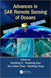
نام کتاب: Advances In Sar Remote Sensing Of Oceans
نویسنده: Xiaofeng Li, Huadong Guo, Kun-Shan Chen, Xiaofeng Yang
ویرایش: ۱
سال انتشار: ۲۰۱۸
کد ISBN کتاب: ۹۷۸۱۳۵۱۲۳۵۸۱۵, ۱۳۵۱۲۳۵۸۱۸
فرمت: PDF
تعداد صفحه: ۳۶۳
انتشارات: Garland Science
Description About Book Advances In Sar Remote Sensing Of Oceans From Amazon
The oceans cover approximately 71% of Earth’s surface, 90% of the biosphere and contains 97% of Earth’s water. Since the first launch of SEASAT satellite in 1978, an increasing number of SAR satellites have or will become available, such as the European Space Agency’s ERS-1/-2, ENVISAT, and Sentinel-1 series; the Canadian RADARSAT-1/-2 and the upcoming RADARSAT Constellation Mission series satellites; the Italian COSMO-SkyMed satellites, the German TERRASAR-X and TANDEM-X, and the Chinese GAOFEN-3 SAR, among others. Recently, European Space Agency has launched a new generation of SAR satellites, Sentinel-1A in 2014 and Sentinel-1B in 2016. These SAR satellites provide researchers with free and open SAR images necessary to carry out their research on the global oceans. The scope of Advances in SAR Remote Sensing of Oceans is to demonstrate the types of information that can be obtained from SAR images of the oceans, and the cutting-edge methods needed for analysing SAR images.
Written by leading experts in the field, and divided into four sections, the book presents the basic principles of radar backscattering from the ocean surface; introduces the recent progresses in SAR remote sensing of dynamic coastal environment and management; discusses the state-of-the-art methods to monitor parameters or phenomena related to the dynamic ocean environment; and deals specifically with new techniques and findings of marine atmospheric boundary layer observations.
Advances in SAR Remote Sensing of Oceans is a very comprehensive and up-to-date reference intended for use by graduate students, researchers, practitioners, and R&D engineers working in the vibrant field of oceans, interested to understand how SAR remote sensing can support oceanography research and applications.
درباره کتاب Advances In Sar Remote Sensing Of Oceans ترجمه شده از گوگل
اقیانوس ها را پوشش حدود ۷۱ درصد از سطح کره زمین، ۹۰ درصد از زیست کره و شامل ۹۷٪ آب زمین. از آنجا که راه اندازی اولین ماهواره SEASAT در سال ۱۹۷۸، تعداد فزاینده ای از ماهواره های SAR اند و یا در دسترس تبدیل خواهد شد، مانند ERS-1 آژانس فضایی اروپا / -۲، ENVISAT، و نگهبان-۱ سری؛ کانادا RADARSAT-1 / -2 و آینده ماهواره سری RADARSAT صورت فلکی ماموریت؛ ایتالیایی COSMO-SkyMed ماهواره، آلمانی تراسار-ایکس و Tandem-X، و چینی ها GAOFEN-3 SAR، در میان دیگران. به تازگی، آژانس فضایی اروپا نسل جدیدی از ماهواره SAR، نگهبان-۱A در سال ۲۰۱۴ و نگهبان-۱B در سال ۲۰۱۶٫ راه اندازی کرده است این ماهواره SAR در اختیار پژوهشگران با تصاویر SAR آزاد و باز لازم برای انجام تحقیقات خود را در اقیانوس جهانی است. دامنه پیشرفت در SAR سنجش از دور از اقیانوس است برای نشان دادن انواع اطلاعاتی که می توان از تصاویر SAR از اقیانوس ها به دست آمده، و روش برش لبه مورد نیاز برای تجزیه و تحلیل تصاویر SAR.
نوشته شده توسط کارشناسان برجسته در این زمینه، و تقسیم به چهار بخش، این کتاب اصول اساسی backscattering رادار از سطح اقیانوس؛ معرفی پیشرفتهای اخیر در SAR سنجش از دور از محیط زیست ساحلی پویا و مدیریت؛ بحث در مورد روش دولت از هنر، به پارامترهای مانیتور و یا پدیده های مربوط به محیط زیست اقیانوس پویا. و معاملات به طور خاص با تکنیک ها و یافته های مشاهدات دریایی لایه مرزی جو جدید است.
پیشرفت در SAR سنجش از دور اقیانوس ها است تا به امروز مرجع بسیار جامع و برای استفاده توسط دانشجویان تحصیلات تکمیلی، محققان، پزشکان و مهندسان تحقیق و توسعه کار در زمینه پر جنب و جوش از اقیانوس ها، علاقه مند در نظر گرفته شده برای درک اینکه چگونه SAR سنجش از دور می تواند حمایت از اقیانوس شناسی تحقیق و برنامه های کاربردی.
[box type=”info”]![]() جهت دسترسی به توضیحات این کتاب در Amazon اینجا کلیک کنید.
جهت دسترسی به توضیحات این کتاب در Amazon اینجا کلیک کنید.![]() در صورت خراب بودن لینک کتاب، در قسمت نظرات همین مطلب گزارش دهید.
در صورت خراب بودن لینک کتاب، در قسمت نظرات همین مطلب گزارش دهید.

