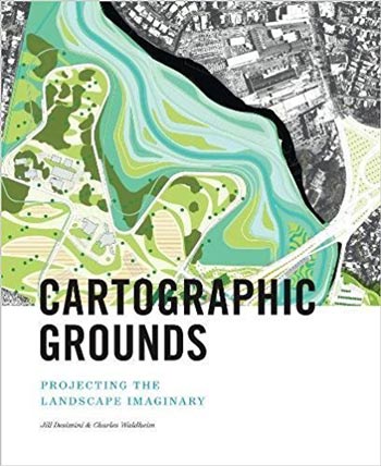
نام کتاب: Cartographic Grounds Projecting the Landscape Imaginary
نویسنده: Jill Desimini, Charles Waldheim, Mohsen Mostafavi
ویرایش: ۱
سال انتشار: ۲۰۱۶
فرمت: PDF
تعداد صفحه: ۲۷۲
انتشارات: Princeton Architectural Press
Description About Cartographic Grounds Projecting the Landscape Imaginary From Amazon
Mapping has been one of the most fertile areas of exploration for architecture and landscape in the past few decades. While documenting this shift in representation from the material and physical description toward the depiction of the unseen and often immaterial, Cartographic Grounds takes a critical view toward the current use of data mapping and visualization and calls for a return to traditional cartographic techniques to reimagine the manifestation and manipulation of the ground itself.
Each of the ten chapters focuses on a single cartographic technique—sounding/spot elevation, isobath/contour, hachure/hatch, shaded relief, land classification, figure-ground, stratigraphic column, cross-section, line symbol, conventional sign—and illustrates it through beautiful maps and plans from notable designers and cartographers throughout history, from Leonardo da Vinci to James Corner Field Operations. Mohsen Mostafavi, dean of the Harvard Graduate School of Design, introduces the book.
درباره کتاب Cartographic Grounds Projecting the Landscape Imaginary – ترجمه شده از گوگل
نقشه برداری در چند دهه گذشته یکی از زمینه های پربارترین اکتشاف برای معماری و چشم انداز بوده است. در حالی که این تغییر را در نمایندگی از توصیف مواد و فیزیکی به تصویر کشیدن از غریزه غیرقابل مشاهده و اغلب غیرمترقبه مستند می کند، زمینه های نقشه کشی، دیدگاه انتقادی نسبت به استفاده فعلی از نقشه برداری و تجسم داده ها را می گیرد و خواستار بازگشت به تکنیک های کارتوگرافی سنتی برای تجدید ظهور می شود و دستکاری از زمین خود.
هر کدام از ده فصل بر روی یک روش نقشه کشی، ارتفاع / نقطه ای، ایزو بت / کانتور، هچور / هچ، تسکین سایهدار، طبقه بندی زمین، چهره زمین، ستون چینه شناسی، مقطع عرضی، نماد خط، نماد متعارف و نشان داده شده است. آن را از طریق نقشه های زیبا و برنامه های طراحان و نقشه کاران قابل توجه در طول تاریخ، از لئوناردو داوینچی به جیمز Corner عملیات زمینه. محسن مصطفوی، دبیر دانشکده طراحی فارغ التحصیل دانشگاه هاروارد، این کتاب را معرفی می کند.
[box type=”info”]![]() جهت دسترسی به توضیحات این کتاب در Amazon اینجا کلیک کنید.
جهت دسترسی به توضیحات این کتاب در Amazon اینجا کلیک کنید.![]() در صورت خراب بودن لینک کتاب، در قسمت نظرات همین مطلب گزارش دهید.
در صورت خراب بودن لینک کتاب، در قسمت نظرات همین مطلب گزارش دهید.
[tabs slidertype=”simple” auto=”yes”] [tab]
دسته های پرطرفدار دانلود کتاب معماری
- دانلود کتاب معماری پایدار
- دانلود کتاب معماری منظر
- دانلود کتاب معماری داخلی
- دانلود کتاب تاریخ معماری
- دانلود کتاب جزئیات در معماری
- دانلود کتاب آثار معماران بزرگ
- دانلود کتاب سازه در معماری
- دانلود کتاب طراحی شهری
- دانلود کتاب معماری دیجیتال
- دانلود کتاب روانشناسی محیطی
- دانلود کتاب راندو و اسکیس
[/tab] [/tabs]

