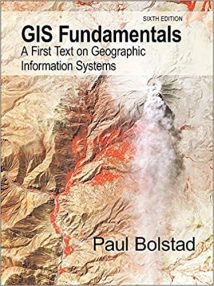
نام کتاب: Gis Fundamentals – A First Text On Geographic Information Systems
نویسنده: Paul Bolstad
ویرایش: ۶
سال انتشار: ۲۰۱۹
کد ISBN کتاب: ۹٫۷۸E+12
فرمت: PDF
تعداد صفحه: ۷۶۴
انتشارات: Eider Press
Description About Book Gis Fundamentals – A First Text On Geographic Information Systems From Amazon
NEW and UPDATED 6th ویرایشof the best selling GIS Fundamentals textbook by Paul Bolstad!
A First Text on Geographic Information Systems Geographic Information Systems (GIS) are computer-based tools for the entry, maintenance, and analysis of spatial data. GIS are critical for effective resource management, and have been applied across a wide range of science, business, and government endeavours.
This book provides an introduction to the theory and application of GIS. It is written for use in a first-year GIS class and as a reference for the GIS practitioner. This sixth edition balances theoretical and practical material, so that students may apply knowledge of GIS in the solution of real-world problems.
Improvements over the previous editions are included in each chapter. Topics treated include an introduction to GIS, spatial data models, map projections, data entry, image data, GPS, digital data, database systems in GIS, general spatial analysis, raster analysis, terrain modeling, metadata, standards, and accuracy assessments. The bestselling GIS textbook by Paul Bolstad is now even better!
Improvements in GIS Fundamentals, 6th ویرایش.
Updates to improve clarity in each chapter include:
۸۰+ new or modified figures.
Additional and edited questions at the end of each chapter.
Expanded discussion of topology and three dimensional data models.
Added descriptions of the new national 2022 datum, vertical datum adjustment, and local sea level datums.
Description of new and modernized GNSS systems.
Reorganization of the chapter on remote sensing, and updates to cover new satellite systems and methods.
Focused improvements in the databases chapter on foreign keys and multi-table joins.
Reorganization of the introductory analysis chapter, expanded coverage on reclassification, and a new discussion on attribute recalculations during dissolve operations.
Updates on new methods in raster and terrain analysis chapters.
Expanded description of applied spatial models.
Updated glossary, data sources, and useful conversions and formulas appendices.
درباره کتاب Gis Fundamentals – A First Text On Geographic Information Systems ترجمه شده از گوگل
جدید و به روز نسخه ۶ از بهترین اصول فروش GIS کتاب درسی توسط پل Bolstad!
متن برای اولین بار در سیستم اطلاعات جغرافیایی جغرافیایی سیستم اطلاعات جغرافیایی (GIS) ابزار مبتنی بر کامپیوتر برای ورود، تعمیر و نگهداری، و تجزیه و تحلیل داده های مکانی می باشد. GIS برای مدیریت منابع موثر، ضروری هستند و در سراسر طیف گسترده ای از تلاش علم، کسب و کار، و دولت اعمال شده است.
این کتاب مقدمه ای بر نظریه و کاربرد GIS فراهم می کند. این است که برای استفاده در یک کلاس GIS سال اول و به عنوان یک مرجع برای پزشک GIS نوشته شده است. این نسخه ششم تعادل مواد نظری و عملی، به طوری که دانش آموزان ممکن است دانش GIS در حل مسائل دنیای واقعی اعمال می شود.
بهبود بیش از نسخه های قبلی در هر فصل گنجانده شده است. مباحث درمان شامل مقدمه ای بر GIS، مدل داده های فضایی، پیش بینی نقشه، ورود اطلاعات، داده های تصویر، GPS، داده های دیجیتال، سیستم های پایگاه داده در GIS، تجزیه و تحلیل مکانی به طور کلی، تجزیه و تحلیل شطرنجی، مدل سازی زمین، ابرداده، استانداردها و ارزیابی دقت و صحت. پرفروشترین کتاب درسی GIS توسط پل Bolstad حال حاضر حتی بهتر!
بهبود در GIS اصول، نسخه ۶٫
به روز رسانی به بهبود وضوح در هر فصل عبارتند از:
۸۰+ چهره های جدید یا تغییر یافتهاست.
سوالات اضافی و ویرایشدر پایان هر فصل.
بحث گسترده از توپولوژی و سه مدل داده بعدی.
توصیف اضافه شده از ملی جدید ۲۰۲۲ داده، تنظیم داده عمودی، و datums نقشه از سطح دریا محلی است.
شرح سیستم های جدید و مدرن GNSS.
تنظیم مجدد از فصل مربوط به سنجش از دور، و به روز رسانی برای پوشش سیستم های ماهواره ای و روش های جدید.
بهبود متمرکز در فصل پایگاه داده بر روی کلید خارجی و چند جدول می پیوندد.
تنظیم مجدد از فصل تجزیه و تحلیل مقدماتی، گسترش پوشش در طبقه بندی، و بحث جدید در یامحاسبات مجدد ویژگی در طول حل عملیات.
به روز رسانی در روش های جدید در شطرنجی و تجزیه و تحلیل زمین فصل است.
توضیحات گسترده ای از مدل های فضایی استفاده می شود.
به روز رسانی واژه نامه، منابع داده ها، و تبدیل و فرمول مفید ضمائم.
[box type=”info”]![]() جهت دسترسی به توضیحات این کتاب در Amazon اینجا کلیک کنید.
جهت دسترسی به توضیحات این کتاب در Amazon اینجا کلیک کنید.![]() در صورت خراب بودن لینک کتاب، در قسمت نظرات همین مطلب گزارش دهید.
در صورت خراب بودن لینک کتاب، در قسمت نظرات همین مطلب گزارش دهید.

