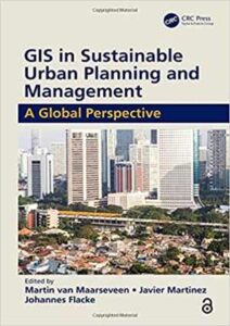
نام کتاب: Gis In Sustainable Urban Planning And Management
نویسنده: Johannes Flacke و Martin Van Maarseveen و Javier Martinez
ویرایش: ۱
سال انتشار: ۲۰۱۹
کد ISBN کتاب: ۹۷۸۱۱۳۸۵۰۵۵۵۱, ۱۱۳۸۵۰۵۵۵۲, ۹۷۸۱۳۱۵۱۴۶۶۳۸, ۱۳۱۵۱۴۶۶۳۰, ۹۷۸۱۳۵۱۳۷۹۰۷۶, ۱۳۵۱۳۷۹۰۷۰, ۹۷۸۱۳۵۱۳۷۹۰۸۳, ۱۳۵۱۳۷۹۰۸۹, ۹۷۸۱۳۵۱۳۷۹۰۹۰, ۱۳۵۱۳۷۹۰۹۷,
فرمت: PDF
تعداد صفحه: ۳۶۴
حجم کتاب: ۱۵۷ مگابایت
کیفیت کتاب: ocr
انتشارات: CRC Press
Description About Book Gis In Sustainable Urban Planning And Management From Amazon
GIS is used today to better understand and solve urban problems. This book explores and illustrates the use of geo-information in the planning and management of urban regions. The first part of the book addresses the concept of sustainable urban development, its different frameworks, the many ways of measuring sustainability, and its value in the urban policy arena. The second part discusses how urban planning can shape our cities, examines various spatial configurations of cities, the spread of activities, and the demands placed on different functions to achieve strategic objective. It further focuses on the recognition that urban dwellers are increasingly under threat from natural hazards and climate change. Read more…
Abstract: GIS is used today to better understand and solve urban problems. This book explores and illustrates the use of geo-information in the planning and management of urban regions. The first part of the book addresses the concept of sustainable urban development, its different frameworks, the many ways of measuring sustainability, and its value in the urban policy arena. The second part discusses how urban planning can shape our cities, examines various spatial configurations of cities, the spread of activities, and the demands placed on different functions to achieve strategic objective. It further focuses on the recognition that urban dwellers are increasingly under threat from natural hazards and climate change
درباره کتاب Gis In Sustainable Urban Planning And Management ترجمه شده از گوگل
امروزه از GIS برای درک بهتر و حل مشکلات شهری استفاده می شود. این کتاب استفاده از اطلاعات جغرافیایی در برنامه ریزی و مدیریت مناطق شهری را بررسی و نشان می دهد. قسمت اول این کتاب به مفهوم توسعه پایدار شهری ، چارچوب های مختلف آن ، بسیاری از روش های اندازه گیری پایداری و ارزش آن در صحنه سیاست های شهری پرداخته است. بخش دوم در مورد چگونگی برنامه ریزی شهری می تواند شهرهای ما را شکل دهد ، تنظیمات مختلف فضایی شهرها ، گسترش فعالیت ها و خواسته های مختلف برای دستیابی به هدف استراتژیک را بررسی می کند. این مقاله بیشتر بر این نکته تأکید دارد که ساکنان شهرها به طور فزاینده ای در معرض تهدیدهای خطرات طبیعی و تغییرات اقلیمی قرار دارند. ادامه مطلب …
چکیده: امروزه از GIS برای درک بهتر و حل مشکلات شهری استفاده می شود. این کتاب استفاده از اطلاعات جغرافیایی در برنامه ریزی و مدیریت مناطق شهری را بررسی و نشان می دهد. قسمت اول این کتاب به مفهوم توسعه پایدار شهری ، چارچوب های مختلف آن ، بسیاری از روش های اندازه گیری پایداری و ارزش آن در صحنه سیاست های شهری پرداخته است. بخش دوم در مورد چگونگی برنامه ریزی شهری می تواند شهرهای ما را شکل دهد ، تنظیمات مختلف فضایی شهرها ، گسترش فعالیت ها و خواسته های مختلف برای دستیابی به هدف استراتژیک را بررسی می کند. این مقاله بیشتر بر این نکته تأکید دارد که ساکنان شهرها به طور فزاینده ای در معرض تهدیدهای خطرات طبیعی و تغییرات اقلیمی قرار دارند
[box type=”info”]![]() جهت دسترسی به توضیحات این کتاب در Amazon اینجا کلیک کنید.
جهت دسترسی به توضیحات این کتاب در Amazon اینجا کلیک کنید.![]() در صورت خراب بودن لینک کتاب، در قسمت نظرات همین مطلب گزارش دهید.
در صورت خراب بودن لینک کتاب، در قسمت نظرات همین مطلب گزارش دهید.

