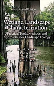
نام کتاب: Wetland Landscape Characterization – Practical Tools, Methods, And Approaches For Landscape Ecology
نویسنده: Sylvain Ménard و Marcel Darveau و Louis Imbeau
ویرایش: ۲
سال انتشار: ۲۰۱۳
کد ISBN کتاب: ۹۷۸۱۴۶۶۵۰۳۷۶۲, ۹۷۸۱۴۶۶۵۰۴۳۲۵
فرمت: PDF
تعداد صفحه: ۳۰۸
انتشارات: Crc Press
Description About Book Wetland Landscape Characterization – Practical Tools, Methods, And Approaches For Landscape Ecology From Amazon
Boreal wetlands are recognized as important wildlife habitats, especially as breeding and staging grounds for a large number of waterfowl. The main objectives of this study were to quantify the distribution of wetland and aquatic wildlife-habitat landscape types within boreal Quebec and to determine how such recognizable wildlife habitats vary among climatic regimes and landforms. A total of 456 forest maps systematically distributed within a 540000 km 2 area were used to classify 12 wetland and 5 different aquatic habitat types. Habitat types belonging to wetland and aquatic classes respectively covered 10.3 % and 11.7 % of the study area. Spatial heterogeneity was confirmed using a hierarchical cluster analysis by identification of 6 wetland landscape types further categorized into 3 groups: wet, dry, and anthropogenic. The last emphasizes the magnitude of human alteration of aquatic habitats, with reservoirs representing 26% of total water coverage. Partial redundancy analyses showed that landform data alone had better explanatory power (28%) than climatic data (19%) to account for the variation in wetland coverage. These results suggest that terrestrial ecozones based on landform (rather than climate) could serve as indicators for wetland conservation planning and facilitate wetland conservation and management decisions. Read more…
Abstract: Boreal wetlands are recognized as important wildlife habitats, especially as breeding and staging grounds for a large number of waterfowl. The main objectives of this study were to quantify the distribution of wetland and aquatic wildlife-habitat landscape types within boreal Quebec and to determine how such recognizable wildlife habitats vary among climatic regimes and landforms. A total of 456 forest maps systematically distributed within a 540000 km 2 area were used to classify 12 wetland and 5 different aquatic habitat types. Habitat types belonging to wetland and aquatic classes respectively covered 10.3 % and 11.7 % of the study area. Spatial heterogeneity was confirmed using a hierarchical cluster analysis by identification of 6 wetland landscape types further categorized into 3 groups: wet, dry, and anthropogenic. The last emphasizes the magnitude of human alteration of aquatic habitats, with reservoirs representing 26% of total water coverage. Partial redundancy analyses showed that landform data alone had better explanatory power (28%) than climatic data (19%) to account for the variation in wetland coverage. These results suggest that terrestrial ecozones based on landform (rather than climate) could serve as indicators for wetland conservation planning and facilitate wetland conservation and management decisions
درباره کتاب Wetland Landscape Characterization – Practical Tools, Methods, And Approaches For Landscape Ecology ترجمه شده از گوگل
تالاب های شمالی به عنوان زیستگاه های مهم حیات وحش رسمیت شناخته شده، به خصوص به عنوان پرورش و برگزاری زمینه را برای تعداد زیادی از پرندگان آبزی. اهداف اصلی از این مطالعه برای تعیین کمیت توزیع تالاب و انواع چشم انداز حیات وحش زیستگاه آبزیان در شمالی کبک و برای تعیین چنین زیستگاه حیات وحش تشخیص میان رژیم آب و هوایی و لندفرم متفاوت است. در مجموع ۴۵۶ جنگل نقشه سیستماتیک در یک ۵۴۰۰۰۰ کیلومتر ۲ منطقه توزیع به طبقه بندی ۱۲ تالاب و ۵ نوع مختلف زیستگاه های آبی استفاده شده است. انواع زیستگاه متعلق به تالاب ها و کلاس های آبزی به ترتیب تحت پوشش ۱۰٫۳٪ و ۱۱٫۷٪ از منطقه مورد مطالعه. مرطوب، خشک، و انسانی: ناهمگنی فضایی با استفاده از تجزیه و تحلیل خوشه ای سلسله مراتبی توسط شناسایی انواع چشم انداز ۶ تالاب بیشتر در ۳ گروه تایید شد. آخرین بر بزرگی تغییر انسان از زیستگاه های آبی، با مخازن نمایندگی ۲۶ درصد از پوشش کل آب است. افزونگی جزئی تجزیه و تحلیل نشان داد که داده های لندفرم تنهایی قدرت توضیحی بهتر (۲۸٪) از داده های اقلیمی (۱۹٪) به حساب برای تغییر در پوشش تالاب بود. این نتایج نشان می دهد که ecozones زمینی بر اساس لندفرم (به جای آب و هوا) می تواند به عنوان شاخص برای برنامه ریزی حفاظت از تالاب و تسهیل حفاظت و مدیریت تصمیم گیری تالاب. ادامه مطلب …
چکیده: تالاب بروئال به عنوان زیستگاه های مهم حیات وحش رسمیت شناخته شده، به خصوص به عنوان پرورش و برگزاری زمینه را برای تعداد زیادی از پرندگان آبزی. اهداف اصلی از این مطالعه برای تعیین کمیت توزیع تالاب و انواع چشم انداز حیات وحش زیستگاه آبزیان در شمالی کبک و برای تعیین چنین زیستگاه حیات وحش تشخیص میان رژیم آب و هوایی و لندفرم متفاوت است. در مجموع ۴۵۶ جنگل نقشه سیستماتیک در یک ۵۴۰۰۰۰ کیلومتر ۲ منطقه توزیع به طبقه بندی ۱۲ تالاب و ۵ نوع مختلف زیستگاه های آبی استفاده شده است. انواع زیستگاه متعلق به تالاب ها و کلاس های آبزی به ترتیب تحت پوشش ۱۰٫۳٪ و ۱۱٫۷٪ از منطقه مورد مطالعه. مرطوب، خشک، و انسانی: ناهمگنی فضایی با استفاده از تجزیه و تحلیل خوشه ای سلسله مراتبی توسط شناسایی انواع چشم انداز ۶ تالاب بیشتر در ۳ گروه تایید شد. آخرین بر بزرگی تغییر انسان از زیستگاه های آبی، با مخازن نمایندگی ۲۶ درصد از پوشش کل آب است. افزونگی جزئی تجزیه و تحلیل نشان داد که داده های لندفرم تنهایی قدرت توضیحی بهتر (۲۸٪) از داده های اقلیمی (۱۹٪) به حساب برای تغییر در پوشش تالاب بود. این نتایج نشان می دهد که ecozones زمینی بر اساس لندفرم (به جای آب و هوا) می تواند به عنوان شاخص برای برنامه ریزی حفاظت از تالاب و تسهیل حفاظت و مدیریت تصمیم گیری تالاب
[box type=”info”]![]() جهت دسترسی به توضیحات این کتاب در Amazon اینجا کلیک کنید.
جهت دسترسی به توضیحات این کتاب در Amazon اینجا کلیک کنید.![]() در صورت خراب بودن لینک کتاب، در قسمت نظرات همین مطلب گزارش دهید.
در صورت خراب بودن لینک کتاب، در قسمت نظرات همین مطلب گزارش دهید.

