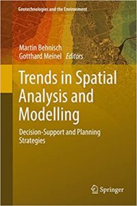
نام کتاب: Trends In Spatial Analysis And Modelling – Decision-Support And Planning Strategies
نویسنده: Martin Behnisch و Gotthard Meinel
ویرایش: ۱
سال انتشار: ۲۰۱۸
کد ISBN کتاب: ۹۷۸۳۳۱۹۵۲۵۲۰۴, ۹۷۸۳۳۱۹۵۲۵۲۲۸
فرمت: PDF
تعداد صفحه: ۲۱۴
انتشارات: Springer International Publishing
Description About Book Trends In Spatial Analysis And Modelling – Decision-Support And Planning Strategies From Amazon
This book is a collection of original research papers that focus on recent developments in Spatial Analysis and Modelling with direct relevance to settlements and infrastructure. Topics include new types of data (such as simulation data), applications of methods to support decision-making, and investigations of human-environment data in order to recognize significance for structures, functions and processes of attributes. Research incorporated ranges from theoretical through methodological to applied work. It is subdivided into four main parts: the first focusing on the research of settlements and infrastructure, the second studies aspects of Geographic Data Mining, the third presents contributions in the field of Spatial Modelling, System Dynamics and Geosimulation, and the fourth part is dedicated to Multi-Scale Representation and Analysis.
The book is valuable to those with a scholarly interest in spatial sciences, urban and spatial planning, as well as anyone interested in spatial analysis and the planning of human settlements and infrastructure.
Most of the selected papers were originally presented at the “International Land Use Symposium (ILUS 2015): Trends in Spatial Analysis and Modelling of Settlements and Infrastructure” November 11-13 2015, in Dresden, Germany.
درباره کتاب Trends In Spatial Analysis And Modelling – Decision-Support And Planning Strategies ترجمه شده از گوگل
این کتاب مجموعه ای از مقالات پژوهشی اصلی که بر تحولات اخیر در تحلیل مکانی و مدل سازی با ارتباط مستقیم به شهرک و زیرساخت است. مباحث عبارتند از انواع جدیدی از اطلاعات (مانند داده های شبیه سازی)، برنامه های کاربردی از روش های به پشتیبانی تصمیم گیری، و تحقیقات از داده های انسان-محیط زیست به منظور به رسمیت شناختن اهمیت برای سازه، توابع و فرآیندهای از صفات. تحقیق محدوده گنجانیده شده از تئوریک از طریق روش به کار اعمال شده است. این است که به چهار بخش اصلی تقسیم است: اول با تمرکز بر پژوهش از شهرک ها و زیرساخت ها، جنبه های مطالعات دوم جغرافیایی داده کاوی، ارائه کمک های سوم در زمینه مدلسازی مکانی، سیستم دینامیک و Geosimulation، و بخش چهارم اختصاص داده شده است به چند مقیاس نمایندگی و تجزیه و تحلیل.
این کتاب با ارزش را به کسانی که با علاقه محققان در علوم فضایی، برنامه ریزی شهری و فضایی، و همچنین به عنوان کسی که علاقه مند در تجزیه و تحلیل مکانی و برنامه ریزی شهرک بشر و زیرساخت است.
۱۱-۱۳ نوامبر ۲۰۱۵، در شهر درسدن آلمان: بسیاری از مقالات انتخاب شده در ابتدا در “روند تحلیل مکانی و مدل سازی شهرک ها و زیرساخت زمین بین المللی استفاده از سمپوزیوم (ILUS 2015)” ارائه شد.
[box type=”info”]![]() جهت دسترسی به توضیحات این کتاب در Amazon اینجا کلیک کنید.
جهت دسترسی به توضیحات این کتاب در Amazon اینجا کلیک کنید.![]() در صورت خراب بودن لینک کتاب، در قسمت نظرات همین مطلب گزارش دهید.
در صورت خراب بودن لینک کتاب، در قسمت نظرات همین مطلب گزارش دهید.

